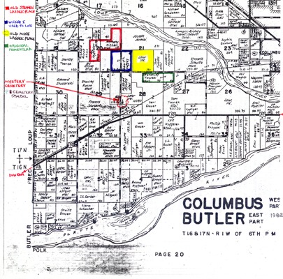
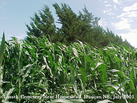
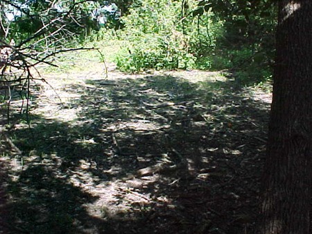
| Lassek Cemetery near the Lassek Homestead, situated on high ground around a grove of Cedar trees. The GPS coordinates are Long 097.28.46W and Lat 41.21.56N. The early church records of St. Stanislaus Duncan Nebraska show this site as the "Lassek Cemetery" and it lists individuals who were buried there. Dean Lassek talked to Mrs. John Lehr of Duncan who was at one time owner of this land. She advised that some time ago she and her husband tried to build a house on this area but were refused permission to do so as the authorities advised at that time that two infant graves still existed at this site. To the best of my knowledge, they are still buried there today (pending research and clarification). |